 March 26-28, 2024 /// Huntsville, AL /// Booth 1228 The TRX Systems team will be exhibiting at the AUSA Global Force Symposium & Exposition next week from March 26-28 in Huntsville, AL. Come visit TRX at booth #1228 in the Von Braun Center to learn how our assured PNT solutions enable dismounted maneuver operations with speed, surprise, and agility in GPS-challenged environments.
The U.S. Army awarded a $9.9 million contract to TRX Systems this week for the DAPS GEN II system, as described in this recent Department of Defense announcement. This award is a follow-on delivery order from the seven-year $402 million IDIQ contract awarded to TRX Systems in March 2023 by the U.S. Army Program Executive Office for Intelligence, Electronic Warfare and Sensors (PEO IEW&S) to deliver DAPS GEN II systems.
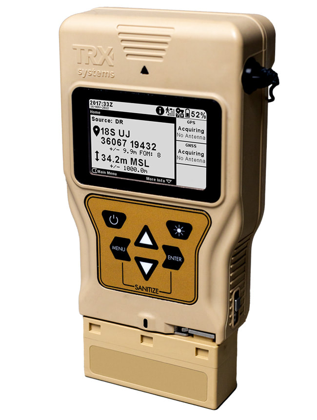
The Army’s Project Manager Positioning, Navigation, and Timing’s (PM PNT) Dismounted team announced the accomplishment of a major milestone this month – completion of the Initial Operational Test and Evaluation (IOT&E) of the TRX DAPS GEN II solution. This is exciting news, coming just a few weeks after TRX’s recent news release announcing that our DAPS GEN II solution is in production and shipping, just five months after a $402 Million Program of Record award from the U.S. Army.  TRX Systems announced today that it is now shipping the Dismounted Assured Positioning, Navigation, and Timing System Generation II (DAPS GEN II) solution, which provides Assured PNT to warfighters operating in GPS-denied environments. Just five months after the U.S. Army Program of Record award, the DAPS GEN II solution, known as TRX DAPS II, is in production and shipping. 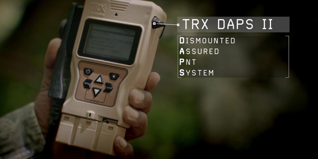 In August, TRX Systems participated in the Sennybridge23 NavWar Trial conducted in Wales, United Kingdom (UK). Organized by the Defence Science and Technology Laboratory (Dstl), which is part of the UK Ministry of Defence, this event gave participating organizations an invaluable opportunity to evaluate warfighter solutions in GNSS-denied conditions. Along with partner Cascade Aviation & Marine (CAM), TRX was invited to Sennybridge23 to demonstrate and test its NEON PT-MIL solution. NEON PT-MIL extends the capabilities of ATAK-equipped warfighters, enabling them to better operate and maintain situational awareness in GNSS-denied situations.  TRX Systems testing NEON PT-MIL during Sennybridge23 Trial TRX Systems has been awarded a $402 Million, seven-year, Indefinite Delivery/Indefinite Quantity (IDIQ) contract by the U.S. Army for the procurement of Dismounted Assured Positioning, Navigation, and Timing System Generation II (DAPS GEN II) systems and services.
Last week, TRX Systems participated in the 2023 Arctic Warrior Experiment (AWE-23) in Rena, Norway which sought new solutions for increasing warfighter capabilities in challenging Arctic environments. In conjunction with our partner, Precision Technic Defense (PTD), TRX was invited to AWE-23 to address the challenges of GNSS-denied operation and navigation. 
TRX Systems is now shipping TRX DAPS devices in volume to the U.S. Army. In 2021, the Army selected TRX to deliver a next-generation DAPS solution enabling warfighters to better target, maneuver, and communicate in GPS-degraded or denied operational environments. Only eight months after the production contract award, TRX began delivering this Quick Reaction Capability (QRC) to the Army.
Next week, TRX will showcase our GPS-denied location tracking solutions at the NATIA 2022 Annual Training Conference and Technology Expo being held at the Kentucky International Convention Center in Louisville, KY.
|
AuthorWrite something about yourself. No need to be fancy, just an overview. Archives
March 2024
Categories |

 RSS Feed
|
|
Company |
|